 rivers | guidebooks | forums | tips | other
.jpg)
Class: III+ ; Flow: 700-2,500 cfs; Ave. Gradient: 6 m/km; Portages: no; Length: (6 +) 7 km; Time: (1 +) 1 hours
Season: year `round ; rafts? yes; Highlights: dam release; Crux move: III+ horizon lines
Put-In: Apuzunga water park (380 m) or above; Take-Out: Masahuat village (340 m) or below on Río Lempa
Description: (click here for general notes about my descriptions)
The Guajoyo run is short but sweet, with its biggest selling point being that it has usually reliable dam-release flows, a rare luxury in Central America. The water comes out bathtub- warm from Lago de Güija on the Guatemalan border (which probably increases its bacteria content) through the Guajoyo hydroelectric plant. 48 El Salvador
A full description is in the Mayan Whitewater El Salvador, Honduras, & Nicaragua guidebook.
Descent History: Unknown; many commercial descents.
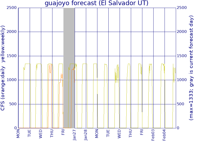
Flow Notes: Water is dam-release from Apuzunga down, from the CEL Guajoyo hydroelectric plant on the Metapán road. The Unidad de Transacciones company publishes a generation (and maintenance) schedule online both one week ahead and then one day ahead at http://www.ut.com.sv/predespacho-diario (the schedules are in spreadsheet format, contact me if you need more information). The schedule lists both generation and spilling flows, and I include both on a graph on the MWW map marker. Flows may be quite limited in hours during the dry season. I also have a contact in the CEL Producción office (2211-6312), Ricardo Pérez, who can confirm near-term releases. There is an online gauge at El Zapotillo, downstream on the Río Lempa, which is another easy way to determine if the daily releases have been regular and at what time. The minimum flow I have seen on the Río Guajoyo is 900 cfs, which was in the dry season. Unless the dam is spilling (which happens in extra rainy years) the maximum release is 1,800 cfs. I would say be extra careful with flows above 2,500 cfs.
 |